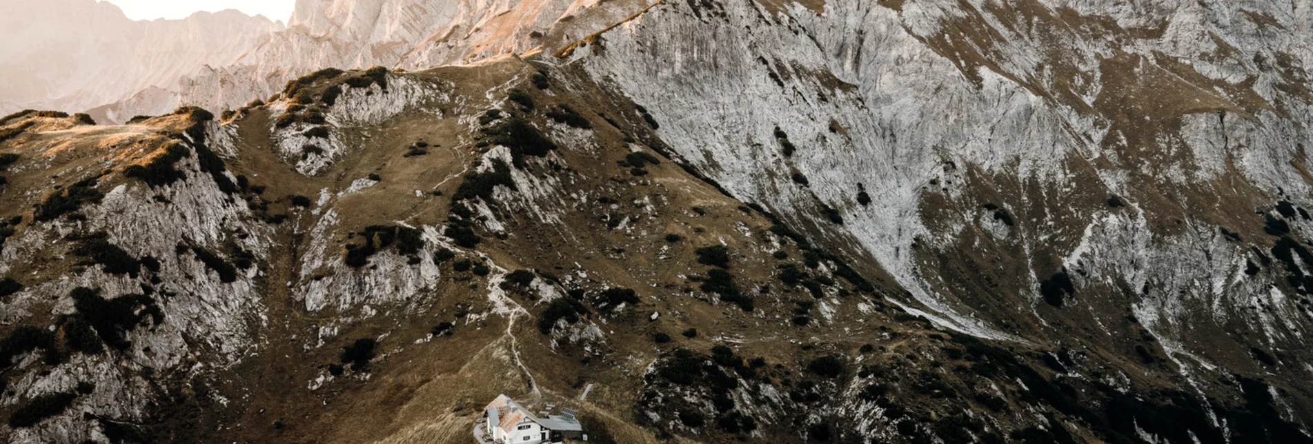
Mountain Hike Natterriegel via Mittagskogel - Touren-Impression #1 | © TV Gesäuse Mountain Hike Natterriegel via Mittagskogel - Touren-Impression #1 | © TV Gesäuse

Natterriegel via Mittagskogel

Open
Ascent from Buchauer Sattel via Grabneralm and Admonterhaus to the Mittagskogel (2041m) and on to the Natterriegel (2065m)
At the Buchauer Sattel, we first hike leisurely across the large meadow until we reach the forest, which leads us uphill partly on  path (trail 636),through the forest, until we finally reach a forest road. We follow this and below the hut the theme path "Almlehrpfad Grabnerstein" begins, the first signs can be read and admired as far as the Grabneralm.

After the Grabneralm we follow the path 636 to the Admonterhaus (1 hour walking time). From there we follow trail 634 first up the Mittagskogel. The path, partly secured with ropes, has alpine character and requires surefootedness.

The easy and short way from there to the summit of the Natterriegel should not be missed.


Characteristics

Skill
Fitness

Best season

January
February
March
April
November
December

The tour in numbers

challenging
Level of difficulty
14,5 km
Route
7:04 h
Time
1202 hm
Uphill
1201 hm
Downhill
2064 m
Highest point

Map & downloads

More information

Coming from Admont: at the Ennsbrücke roundabout, take the Altenmarkt exit and drive approx. 8 km up the Buchauer Sattel, turn left at the top of the pass, parking after 100 m

Coming from St. Gallen: Drive towards Admont for about 12 km on the Buchauer Sattel, turn right at the top of the pass, parking after 100 m

We start at the Buchauer Sattel and hike on a meadow path, then on a forest path and a hollow path until we meet a forest road. Soon we reach the basic border, where the area of the Grabnerhof Agricultural College begins.

From here on, at regular intervals, you will come across information boards depicting past and present alpine pasture farming. This is an entertaining way to get to the Grabneralm.

When we are already tired, hungry and thirsty from the 1 1/2 hour hike, we stop to eat in the cosy garden or in the parlour.

But then we still have an hour's climb ahead of us. A path winds its way uphill until we finally see the Admonter's house majestically enthroned in the embrasure. We have reached our first destination - we might want to spend the night here and then the next morning join the Mittagskogel and Natterriegel (easy hike) or the Hexenturm (only for sure-footed and vertigo-free or via ferrata climbers).

Combinable with Admonter Warte(15min., Grabnerstein and Jungfernsteig(1 1/2h)

For climbers the via ferrata to the Hexenturm is worthwhile(1 1/2h.)

The best thing is to staya night in one of the huts!

To combine see also:

Grabneralm and Grabnerstein (1848 m)

Busline 910 Liezen - Altenmarkt Haltestelle Buchauer Sattel
Car park Admonterhaus/Grabneralm on the Buchauer Sattel
Tourismusverband Gesäuse

Hauptstraße 35, 8911 Admont

Tel. +43 (0) 3613 21160 10

Email: info@gesaeuse.at

www.gesaeuse.at

Freizeit-Wanderkarte Gesäuse - Infobüro Admont

Kompass Wanderkarte Nr. 206 "Nationalpark Gesäuse"

Rother Wanderführer Gesäuse

Gallery

What the weather will be like

St. Gallen (509m)

Morning
foggy
9°C
70%
5 km/h
Noon
weather.icon.04
17°C
15%
5 km/h
Night
sunny
13°C
30%
5 km/h
Light morning rain, but slowly becoming sunny during the day.
Morning
very sunny
9°C
0%
0 km/h
Noon
slightly cloudy
20°C
15%
5 km/h
Night
slightly cloudy
15°C
50%
5 km/h
The day starts sunny, but will be partly cloudy in the afternoon.
06.05.2024
cloudy
7°C 21°C
07.05.2024
foggy
9°C 17°C
08.05.2024
foggy
8°C 15°C

Nearby accommodation options

Continue to search

You may also be interested in

Recommended tours

Accessible by public transport
Klinkehütte mit Admonter Kalbling im Hintergrund | Stefan Leitner | © TV Gesäuse
Accessible by public transport
großer buchstein überquerung_img_2072033 | © Gesäuse - Admont
Gesäuse challenging Open
Route 16,0 km
Duration 5:15 h

Großer Buchstein Crossing

Accessible by public transport
Klinkehütte mit | Stefan Leitner | © TV Gesäuse
Bezirk Liezen medium Open
Route 7,8 km
Duration 5:00 h

From the Klinkehütte to the Admonter Kalbling, Sparafeld and Riffel

Accessible by public transport
Abstieg vom Haindlkar mit Großem Buchstein | Tourismusverband Gesäuse | © TV Gesäuse
Gesäuse medium Open
Route 5,0 km
Duration 2:30 h

Haindlkarhütte Normalweg

Accessible by public transport
Über die Forststraße auf die Grabneralm | Tourismusverband Gesäuse | © TV Gesäuse
Gesäuse medium Open
Route 11,6 km
Duration 6:30 h

Grabneralm with Grabnerstein (1848 m)

Accessible by public transport
Buchsteinhaus | Tourismusverband Gesäuse | © TV Gesäuse
Gesäuse challenging Open
Route 13,0 km
Duration 6:00 h

Großer Buchstein normal trail

Accessible by public transport
erstes stück am Forstweg | Tourismusverband Gesäuse | © TV Gesäuse
Bezirk Liezen medium Open
Route 9,6 km
Duration 3:45 h

Kaiserau-Klinkehütte - Lahngang-Wagenbänkrunde